Have you ever looked at a map and wondered why some countries touch India while others are separated by sea? Every border tells a story about mountains, rivers, people and history. Learning India and its neighbouring countries become much easier when you explore the map region by region rather than memorising names alone.
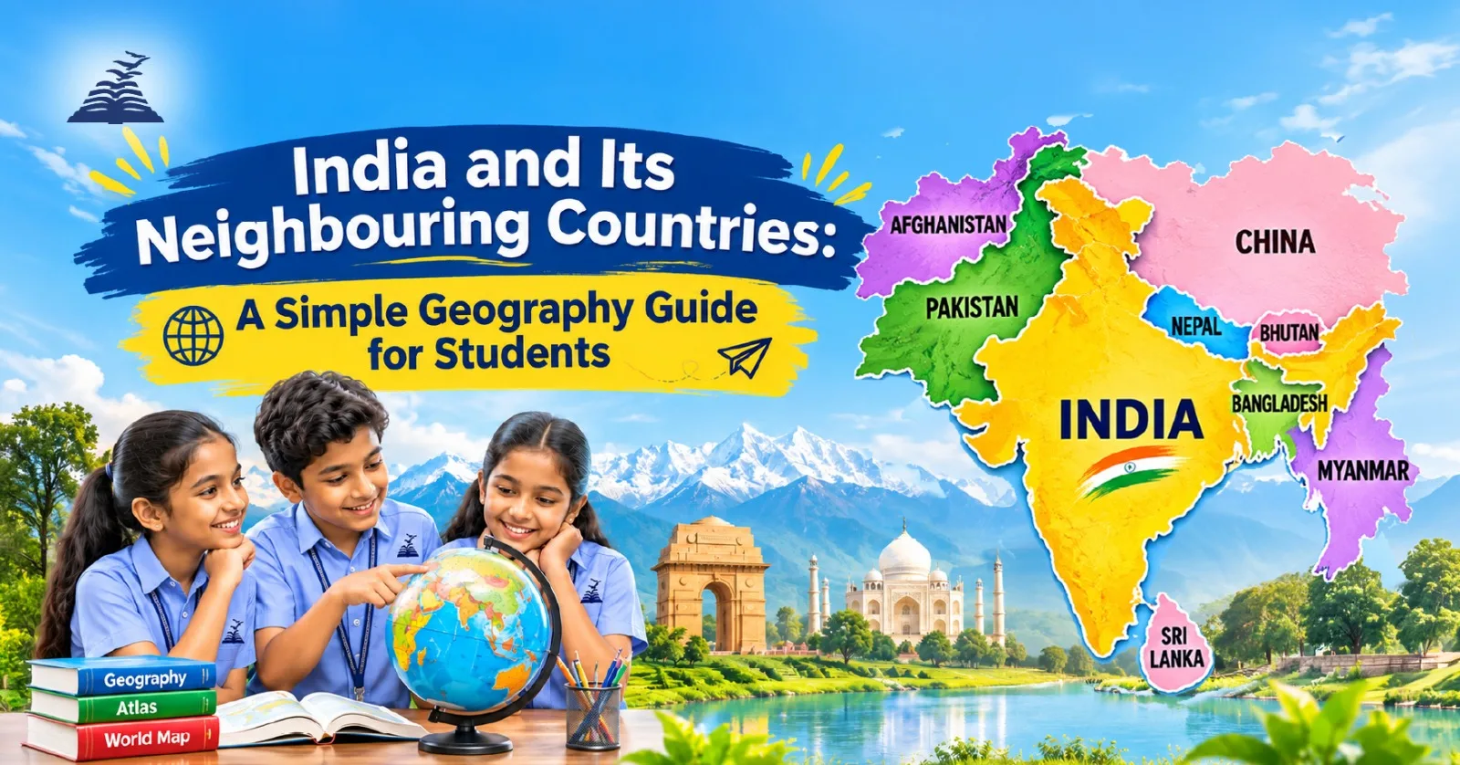
Table of Contents
Understanding Land Neighbours, Island Neighbours and Maritime Boundaries
A land neighbour shares a boundary on land; a maritime neighbour lies across nearby waters or shares a sea boundary. India’s surroundings include Himalayan countries, eastern plains and islands in the Indian Ocean. The list of India’s neighbouring countries commonly includes seven land neighbours and two prominent southern island neighbours, Sri Lanka and the Maldives.
List and borders: countries bordering India, India’s land borders, India’s maritime borders
The India border countries list includes Pakistan, Afghanistan, China, Nepal, Bhutan, Bangladesh and Myanmar. Sri Lanka lies across the Palk Strait, while the Maldives lies southwest of India. Mauritius is a more distant Indian Ocean partner, not a country with a direct land border. Tibet is a region of China, not an independent country.
Border lengths and states: India border length with neighbouring countries, states sharing borders
India’s official land-border total is 15,106.7 km. Among its Bordering Countries, Bangladesh has the longest listed boundary. Government figures are:
| Country | Border length |
| Bangladesh | 4,096.7 km |
| China | 3,488 km |
| Pakistan | 3,323 km |
| Nepal | 1,751 km |
| Myanmar | 1,643 km |
| Bhutan | 699 km |
| Afghanistan | 106 km |
India’s Land Neighbours: A Region-by-Region Overview
Picture India as the centre of a compass. This approach makes India neighbouring countries easier to locate:
- Northwest: Pakistan lies beyond Punjab, Rajasthan and Gujarat. Afghanistan is connected to India’s claim over territory presently under Pakistani administration.
- North: China, Nepal and Bhutan lie along the Himalayas. China’s Tibet Autonomous Region borders areas claimed or administered by India.
- East: Bangladesh is surrounded by Indian territory on three sides; Myanmar extends southeast beyond India’s northeastern hills.
For map practice, notice the states too: West Bengal, Assam, Meghalaya, Tripura and Mizoram border Bangladesh; Arunachal Pradesh, Nagaland, Manipur and Mizoram border Myanmar. Ladakh, Himachal Pradesh, Uttarakhand, Sikkim and Arunachal Pradesh face China.
Named Different Boundaries around India
Borders have changed through treaties, independence and conflict. Some names describe historical boundaries; others identify military positions or disputed areas. Remember these distinctions:
- Radcliffe Line: Drawn in 1947 during Partition; shaped borders with Pakistan and what became Bangladesh.
- Line of Control (LoC): Separates Indian- and Pakistan-administered areas in Kashmir.
- Actual Ground Position Line (AGPL): Marks military positions around Siachen.
- Sir Creek: Disputed tidal estuary between Gujarat and Sindh.
- McMahon Line: Proposed eastern boundary with Tibet in 1914; disputed by China.
- Line of Actual Control (LAC): Separates areas of Indian and Chinese control; its precise alignment is not mutually agreed.
- Durand Line: Afghanistan–Pakistan boundary, not a currently administered India–Afghanistan border.
Neighbouring Countries at a Glance: Capitals, Currencies and Key Geography Facts
A quick table helps students remember capitals and currencies while studying an India map neighbouring countries exercise. Match each capital with its position on the map.
| Country | Capital | Currency |
| Pakistan | Islamabad | Pakistani rupee |
| Afghanistan | Kabul | Afghani |
| China | Beijing | Yuan |
| Nepal | Kathmandu | Nepalese rupee |
| Bhutan | Thimphu | Ngultrum |
| Bangladesh | Dhaka | Taka |
| Myanmar | Naypyidaw (Yangon) | Kyat |
| Sri Lanka | Colombo | Sri Lankan rupee |
| Maldives | Malé | Rufiyaa |
| Mauritius | Port Louis | Mauritian rupee |
Learn with Maps: Locate Countries, Identify Shared Rivers and Practise Geography Questions
Begin with a blank outline map. Label all land neighbours, the Arabian Sea, Bay of Bengal, Palk Strait and major rivers such as the Ganga, Brahmaputra and Indus. Rivers often cross political boundaries, making geography a story of shared landscapes.
Try three activities: label countries without looking; quiz a friend about capitals; discuss why mountain borders differ from river borders.
Student Activity: Home Geography Activity: India’s Neighbourhood Map Challenge
You’ll need: An atlas or a map of South Asia, a sheet of paper and two-coloured pencils.
Time: 15 minutes
- Sketch a rough outline of India and draw a compass arrow pointing north.
- Use your map to locate Nepal, Bangladesh, Sri Lanka and the Maldives. Write each country’s name in the correct position around India.
- Use green for countries that share a land border with India and blue for countries that lie across the sea.
- Write a clue for one country and ask a family member to guess it using your map. For example: “I lie north of India and share a land border with it. Who am I?”
Answer: Nepal
Presidency School Bangalore East: Nurturing Global Perspectives Through Quality Education
Understanding India’s geographical diversity and its neighbouring countries helps students develop global awareness and cultural appreciation. At Presidency School Bangalore East, geography comes alive through engaging classroom discussions, interactive learning, and practical activities. The students of best CBSE school in East Bangalore will be learning geography through maps, discussions and hands-on exercises.
With a comprehensive CBSE curriculum and dedicated educators, the school encourages students to explore geographical concepts, understand international relationships, and appreciate diverse cultures. By fostering curiosity, critical thinking, and environmental awareness, the school prepares young learners to become informed, responsible, and globally conscious citizens.
Conclusion
Understanding India and its neighbouring countries helps students develop a deeper appreciation of geography, history and international relationships. By exploring land borders, maritime boundaries, capitals, currencies and shared geographical features, students can strengthen their geographical knowledge and map-reading skills. Interactive activities, quizzes and regular map practice make learning more engaging and memorable. The top CBSE schools in Bangalore encourage students to ask questions instead of following traditional method of memorising answers. Beyond textbooks, studying India’s neighbours encourages curiosity, cultural awareness and a better understanding of how countries are connected through geography, history and shared resources.